 |
 |
| WELCOME | MAP | SCENIC BYWAY THROUGH THE MOUNTAIN ROUTE | SCENIC BYWAY THROUGH THE MORA RIVER VALLEY | SCENIC BYWAY THROUGH THE SANTA FE- LAS VAGAS CORRIDOR | SCENIC BYWAY THROUGH THE CIMARRON CUTOFF | HISTORY | POINTS OF INTEREST | Contact Us | DRIVING DIRECTIONS | WEBSITE LINKS | EVENTS |
| SCENIC BYWAY THROUGH THE CIMARRON CUTOFF |
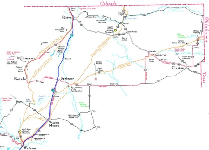
The Cimarron Cutoff portion of the Scenic Byway is drawn in red on the map, and stretches all the way from Clayton to Springer
The Cimarron Cutoff portion of the Scenic Byway begins where the Santa Fe Trail enters New Mexico north and east of Clayton. NM Hwy 410 is the first leg of the Scenic Byway, beginning at the Oklahoma state line and continuing west to the intersection with State Road NM 406. The Santa Fe Trail (SFT) crosses the road very close to the intersection of NM 406 and NM 410.
The Scenic Byway continues south past the Santa Fe Trail landmark of McNees Crossing. Further south on NM 406 you enter the Kiowa National Grassland. Northwest of Seneca, the National Park Service set up a Santa Fe Trail Interpretive Center and a place where you can walk along a section of the Santa Fe Trail as it crosses the grassland. To reach this site go 3 miles west on Campbell Rd then 1 mile north.
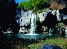
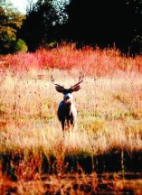
FOLSOM FALLS NORTH OF CAPULIN VOLCANO
AND THE TOWN OF FOLSOM
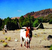
The Byway then continues south until it turns west on US Hwy 56 for the short jaunt in to Clayton. The Chamber of Commerce/Visitor Center in Clayton is located in the south part of town on 1st Street, and can provide you with all the information you need to find Clayton Lake State Park, McNees Crossing, and local Santa Fe Trail landmarks like Rabbit Ear Mountain and Round Mound. The food is very good in Clayton and the people are friendly. Take some time to look around. If you have never seen cattle raised in commercial feedlots, you will here.
The Scenic Byway leaves Clayton heading northwest on US Hwy 64/87 and continues on past Mt. Dora to Grenville. At about mile marker 408 a rest stop has been built where the Cimarron Cutoff of the SFT crosses US Hwy 64. A marker is erected on the spot giving the details. From this point the Santa Fe Trail ruts (which are indistinguishable from this location), are heading just to the west of Round Mound (Mt. Clayton). The Scenic Byway will turn south at the town of Grenville onto NM 453. At about mile marker 15 on NM 453, the SFT crosses the road in front of you. Round Mound is directly east of you at this point. The SFT is angling across the prairie on its way to its next landmark, the Point of Rocks. In order for you to join back up with the trail, the Scenic Byway will continue south on NM 453 until you reach US Hwy 56, where you will turn west toward Springer.
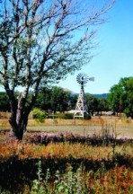
CAPULIN DRY CIMARRON CANYON
The Scenic Byway passes to the south of Point of Rocks and the Dorsey Mansion. The history of this area is recorded on the back side of this map. The Santa Fe Trail actually crosses US Hwy 56 just yards west of mile marker 9. From that point, the Cimarron Cutoff of the SFT heads southwest for the Rock Crossing of the Canadian River which is just about a mile south of where you will cross the Canadian River (mile marker 6). From the Rock Crossing, the SFT turns southward across the prairie, toward Wagon Mound. The Scenic Byway continues on US Hwy 56 all the way to Springer, where the Scenic Byway for both the Mountain Route and the Cimarron Cutoff converge. The driving directions for that portion of the Scenic Byway are given in the description of the Mountain Route section of the Scenic Byway.